Project Area Description and Maps
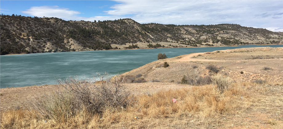
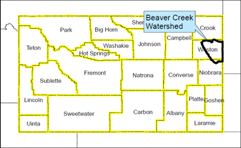 The Beaver Creek watershed, located primarily in Weston County, covers approximately 760,029 acres. Land ownership in
the watershed is predominately private (~74%), federal (~15%), and state (~8%). The Beaver Creek watershed includes the
primary stream system of Beaver Creek, Stockade Beaver Creek, Parmalee Creek, Bear Creek, Salt Creek, Sweetwater Creek,
Freshwater Creek, Oil Creek, West Plum Creek, Big Plum Creek, and Skull Creek. The watershed study also includes Bobcat
Creek, Alkali Creek, Little Alkali Creek in the Cheyenne watershed. Spencer (LAK) Reservoir and Klodt are storage facilities
located in the watershed and are privately owned reservoirs used for irrigation.
The Beaver Creek watershed, located primarily in Weston County, covers approximately 760,029 acres. Land ownership in
the watershed is predominately private (~74%), federal (~15%), and state (~8%). The Beaver Creek watershed includes the
primary stream system of Beaver Creek, Stockade Beaver Creek, Parmalee Creek, Bear Creek, Salt Creek, Sweetwater Creek,
Freshwater Creek, Oil Creek, West Plum Creek, Big Plum Creek, and Skull Creek. The watershed study also includes Bobcat
Creek, Alkali Creek, Little Alkali Creek in the Cheyenne watershed. Spencer (LAK) Reservoir and Klodt are storage facilities
located in the watershed and are privately owned reservoirs used for irrigation.
The Weston County Natural Resource District requested funding for the watershed study from the Wyoming Water Development
Office to evaluate current watershed function and to evaluate irrigation systems, upland livestock/wildlife water management
and rehabilitation opportunities. Other topics of interest in the area are surface water storage including enlargement and/or
rehabilitation of existing water storage facilities, current condition of wetlands and riparian areas, stream restoration and
rangeland evaluations. Information from the watershed study will provide baseline information that the NRD will use to pursue
implementation of management practices that address the natural resource issues in the study area.
For a map of the area, Click here (Adobe required to open the file).
For an interactive Google Earth map, Click here (Google Earth required).